Create 3D cityscape over terrain (advanced help)lines + face
-
Hi, I would like to create a 3d cityscape over a google earth terrain. I have tried everything and I'm stuck.
Right firstly I downloaded a OS map of a city (Lincoln UK)
The file was .gml which was converted to Autocad using a digimap application called interp0se
I have cleaned up the map and imported the AutoCAD lines into sketchup.
I got the 3d terrain within sketchup with geolocation and enabled terrain view to make it 3d.Now I have the problem.
How can I get the whole site and surrounding context onto my terrain.
Well I tried projecting it on with some ruby scripts but the results wern't that good, a lot of lines were missed out and was a bit useless. (I dont know why)I then had the idea to make the faces between the lines and then extrude the whole lot through the terrain and intersect. - I have done this before but the model was Much smaller and it worked fine. I would then delete unwanted geometry and build up layers of buildings by pulling and pushing to different levels. not the projected terrain faces as they cant be pulled but I would overlay another extrution of just buildings. But I ran into a problem and this is why im here. I also tried draping the lines over via the sandbox drape tool.
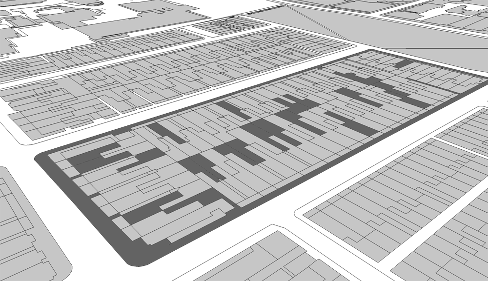
Basically the i cant do this because some faces "bleed" into other face - merging them together. so I have lots of faces I can freely push and pull but some lines arent intersecting with the face there on?!
I tried intersecting with the selected but it didnt do anything and tried projecting it again but nothing changes. I dont get why they arent interacting with each other. I attached some images. I even tried tracing over but it doesnt change anything, im not going to trace over the whole lot though.
I used make faces plug in as well but the results are the same as if I intersect the lines with a face below it.
Basically this will make an amazing 3d model for me to model my architectural project in and also use for analysis of the site, i.e realistic sunlight analysis etc...
2 attachments
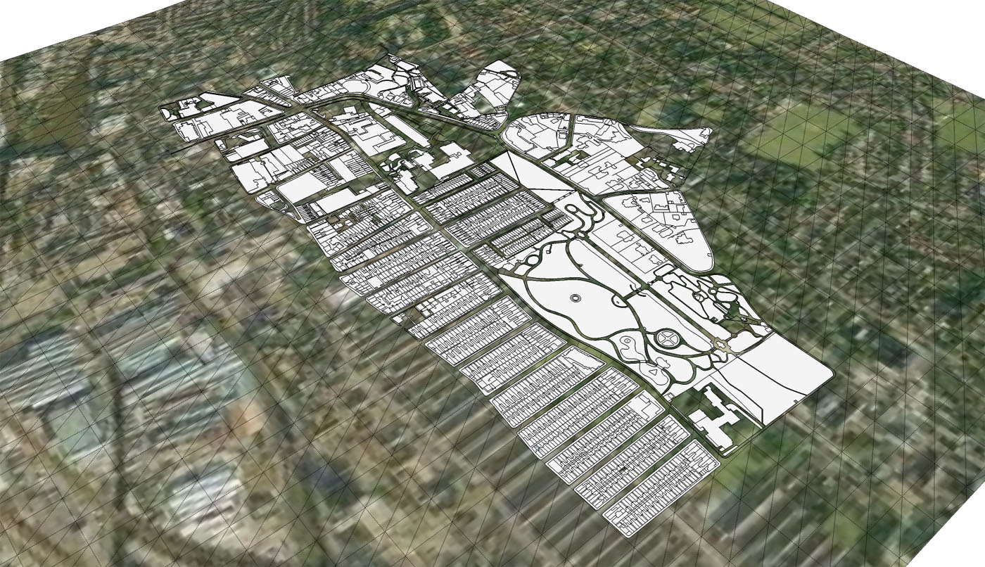
1 - hovering above terrain waiting to be built up

2 - representation of what happens when I click on one face

-
Do the faces "bleed together" in your flat plan view or only after you have attempted to drape/intersect with the terrain below? If the faces are not formed correctly in plan, you should check out several discussions on this forum (including one from this week) on importing AutoCAD files into Sketchup. There are several plugins available here or at smustard.com (some free or $) that can be used to clean up autocad files and possibly fix the problem you've described. If the faces are not forming correctly after your merge the lines with the terrain, you could redraw the missing edges with Fredo's Tools on Surface.
It's also possible that the size of the model is affecting this. On large models, Drape will sometimes grind my machine to a halt. Maybe you could try breaking the city geometry into parts and draping those smaller pieces onto the terrain below. With less geometry to process, it's possible you will get a better result.
-
I know it sounds tedious, but I would use stray lines.rb and label all the lines that are not closing correctly. I would run it over the entire imported CAD model. It will probably label hundereds of lines. Then I would go block by block and fix each broken line until each block was working correctly. IT will take time, but once you get hang of it, it shouldn't take more than 5 minutes per block
 . So yeah, it could be a couple of hours to clean up the whole model. But its worh it so you can have a good clean base model.
Though, looking at your bleeding faces image, it might be more than just stray lines you need to fix. Another method that is helpful is to delete that face that is bleeding. Then go through and redraw each face with the line tool.
Any chance you want to upload your base city model, maybe we could play with it and see what it needs the most of?
Chris
-
thanks for the replies

I found that basically I guess the autocad file was at fault, I flattened all the layers, exploded the poly lines etc... I think the polylines were to fault.
So yeh I managed to sort that one, but I still cant project any geometry onto the terrain even if I explode the terrain or not. It basically maps out the terrain's hidden geometry (triangular faces) and the cad plan onto a flat plane under the terrain?

Tried using the drape and other methods. Could the issue be that projections dont work on a smoothed surface such as the google terrain? I could probably extrude the map and intersect the faces if I need to.
However, I managed to get the model done enough for the analysis. And exported shadows etc...
I set the heights of all the surrounding building context to estimates using my photos and google street view. Works very nicely Will be a brilliant base to model my design in. Shame google terrain isnt more accurate.
The project is going to be a synthetic diamond manufacturer which allows visitors
 Has a lot of meaning in my project but that would take a few A2 pages and a written brief to show you
But basically carbon is the 6th most abundant element in the world, yet in a different form its the most expensive. Just shows how we value things even if they are chemically made of the same substance. Quite interesting. The projects all about the elements and worship. -
Actually you could check it out here if you wanted.
http://www.lukeriggall.co.uk/architecture/worship/I'm thinking about adding paths into the model, I'll import the paths layer from the autocad plan, extrude them and intersect them with a copy of the terrain. then move the paths up the verticle axis and delete the excess terrain. Leaving the original copy of the terrain in the same place untouched. that would make the paths extruded vertically
 - If it wants to intersect properly
-
Check out ThomThom's 'Cleanup' and 'Plan Tools' plugins. I think they would help for this.
Advertisement


