That plugin for adding elevation data....?
-
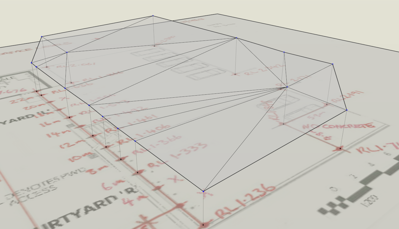
Thanks for chiming in, cotty. what I want to do is to pick a point and add elevation data to establish a referred survey data then select them all and create a terrain or even contours. I've attached the data I have been given and my skippy of the perimeter points jointed together. Ran Curviloft and this is the result.
Also tried toposhaper and found that it didn't stick to my perimeter boundaries....

-
@utiler said:
Thanks for chiming in, cotty. what I want to do is to pick a point and add elevation data to establish a referred survey data then select them all and create a terrain or even contours. I've attached the data I have been given and my skippy of the perimeter points jointed together. Ran Curviloft and this is the result.
Also tried toposhaper and found that it didn't stick to my perimeter boundaries....
Hello Utiler
The following or a variation of it may do what you want.- Create / import points
- Use TIG's Triangulate points to create a mesh (if required)
- Go inside the mesh group and use TAK2HATA's Draw Slope Normals to adjust height of each vertex as required[/list][/list]
Walter
-
Thanks Walter, I'll have a go at that!!
-
I'm just wondering if this is the bets way to create a terrain from survey data provided other than electronic. As per my attachments earlier, I have been given RL's [height date] for a carparking area that I want to model; the data is accurate to all corners so I can easily set out as a profile. Would be good if you guys can give me your comments.
-
@utiler said:
I'm just wondering if this is the bets way to create a terrain from survey data provided other than electronic. As per my attachments earlier, I have been given RL's [height date] for a carparking area that I want to model; the data is accurate to all corners so I can easily set out as a profile. Would be good if you guys can give me your comments.
My view of the world - it depends on the size of the carpark, whether you have an undeveloped carpark (ie no kerbs and islands. Also the spacing of the survey spot heights and the level of accuracy that you want to model.
I would have thought that the process that I had described in my previous post would have been the best available to model the pavement. Kerbs and islands etc could then be superimposed using standard SU entities.
Sometimes surveyors include a 3d mesh covering their spot heights. It might be worth checking with them as they may already have this. It would simplify things.
-
Thanks Walter, the data came to from the builder as lines of paper so no 3D survey data was available. That's why I wanted to build from scratch....
-
What methodology did you end up using.
Regards -
This is what I've done: feedback/advice is welcome.
- import image with survey data; scale to size
- use Jim's 'construction line' tool to draw [with end points] a construction line the height above the image the given height distance.
- run TIG's 'triangulate points' plugin...
- run Fredo's toposhaper' plugin to create terrain....

-
another option that could be used, if all your points are in the perimeter, would be to just connect them all in a perimeter with lines, then select all the lines and run the Soap Bubble plugin...
-
-
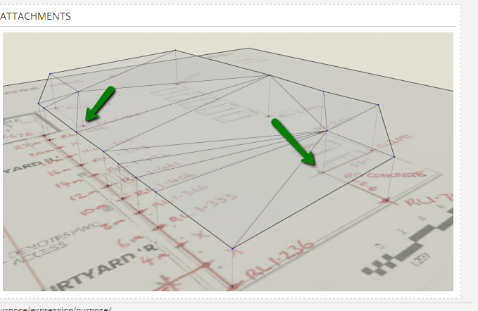
Thanks fellas, as you can see below in this case they were random points on a site so not bounded my a perimeter line.
Quite often I get spot levels given to me on a hardcopy of a plan so I want a simple way to turn elevation data into a reasonable terrain mesh.
-
@utiler said:
Thanks fellas, as you can see below in this case they were random points on a site so not bounded my a perimeter line.
Quite often I get spot levels given to me on a hardcopy of a plan so I want a simple way to turn elevation data into a reasonable terrain mesh.so maybe you shouldn't focus on the perimeter; instead, build a set of 3d points (boundaries AND inside points)
run TIG-points cloud triangulation
http://sketchucation.com/forums/viewtopic.php?t=34232i am not sure about the result with as few points as in your example
-
Thanks glro, that's what I've done.

Hello! It looks like you're interested in this conversation, but you don't have an account yet.
Getting fed up of having to scroll through the same posts each visit? When you register for an account, you'll always come back to exactly where you were before, and choose to be notified of new replies (either via email, or push notification). You'll also be able to save bookmarks and upvote posts to show your appreciation to other community members.
With your input, this post could be even better 💗
Register Login


Advertisement