sketchucation logo sketchucation
    • Login
    ๐Ÿ›ฃ๏ธ Road Profile Builder | Generate roads, curbs and pavements easily Download

    That plugin for adding elevation data....?

    Scheduled Pinned Locked Moved Plugins
    22 Posts 8 Posters 1.5k Views 8 Watching
    Loading More Posts
    • Oldest to Newest
    • Newest to Oldest
    • Most Votes
    Reply
    • Reply as topic
    Log in to reply
    This topic has been deleted. Only users with topic management privileges can see it.
    • utilerU Offline
      utiler
      last edited by

      Thanks Walter, I'll have a go at that!! ๐Ÿ‘ ๐Ÿ‘

      purpose/expression/purpose/....

      1 Reply Last reply Reply Quote 0
      • utilerU Offline
        utiler
        last edited by

        I'm just wondering if this is the bets way to create a terrain from survey data provided other than electronic. As per my attachments earlier, I have been given RL's [height date] for a carparking area that I want to model; the data is accurate to all corners so I can easily set out as a profile. Would be good if you guys can give me your comments.

        purpose/expression/purpose/....

        1 Reply Last reply Reply Quote 0
        • S Offline
          seasdes
          last edited by

          @utiler said:

          I'm just wondering if this is the bets way to create a terrain from survey data provided other than electronic. As per my attachments earlier, I have been given RL's [height date] for a carparking area that I want to model; the data is accurate to all corners so I can easily set out as a profile. Would be good if you guys can give me your comments.

          My view of the world - it depends on the size of the carpark, whether you have an undeveloped carpark (ie no kerbs and islands. Also the spacing of the survey spot heights and the level of accuracy that you want to model.

          I would have thought that the process that I had described in my previous post would have been the best available to model the pavement. Kerbs and islands etc could then be superimposed using standard SU entities.

          Sometimes surveyors include a 3d mesh covering their spot heights. It might be worth checking with them as they may already have this. It would simplify things.

          Using Sketchup Pro 2019

          1 Reply Last reply Reply Quote 0
          • utilerU Offline
            utiler
            last edited by

            Thanks Walter, the data came to from the builder as lines of paper so no 3D survey data was available. That's why I wanted to build from scratch....

            ๐Ÿ‘

            purpose/expression/purpose/....

            1 Reply Last reply Reply Quote 0
            • S Offline
              seasdes
              last edited by

              What methodology did you end up using.
              Regards

              Using Sketchup Pro 2019

              1 Reply Last reply Reply Quote 0
              • utilerU Offline
                utiler
                last edited by

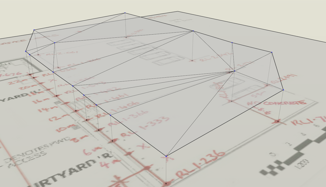
                This is what I've done: feedback/advice is welcome.

                1. import image with survey data; scale to size
                2. use Jim's 'construction line' tool to draw [with end points] a construction line the height above the image the given height distance.
                3. run TIG's 'triangulate points' plugin...
                4. run Fredo's toposhaper' plugin to create terrain....

                ๐Ÿ˜


                triangulate.points.png

                purpose/expression/purpose/....

                1 Reply Last reply Reply Quote 0
                • A Offline
                  AcesHigh
                  last edited by

                  another option that could be used, if all your points are in the perimeter, would be to just connect them all in a perimeter with lines, then select all the lines and run the Soap Bubble plugin...

                  1 Reply Last reply Reply Quote 0
                  • pilouP Offline
                    pilou
                    last edited by

                    @unknownuser said:

                    and run the Soap Bubble plugin

                    or Ferrari one ๐Ÿ˜‰

                    Frenchy Pilou
                    Is beautiful that please without concept!
                    My Little site :)

                    1 Reply Last reply Reply Quote 0
                    • utilerU Offline
                      utiler
                      last edited by

                      Thanks fellas, as you can see below in this case they were random points on a site so not bounded my a perimeter line.
                      Quite often I get spot levels given to me on a hardcopy of a plan so I want a simple way to turn elevation data into a reasonable terrain mesh. ๐Ÿ‘
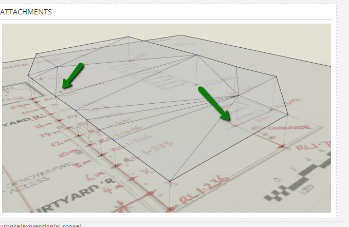

                      2014-08-24_1452.png

                      purpose/expression/purpose/....

                      1 Reply Last reply Reply Quote 0
                      • G Offline
                        glro
                        last edited by

                        @utiler said:

                        Thanks fellas, as you can see below in this case they were random points on a site so not bounded my a perimeter line.
                        Quite often I get spot levels given to me on a hardcopy of a plan so I want a simple way to turn elevation data into a reasonable terrain mesh. ๐Ÿ‘

                        so maybe you shouldn't focus on the perimeter; instead, build a set of 3d points (boundaries AND inside points)

                        run TIG-points cloud triangulation
                        http://sketchucation.com/forums/viewtopic.php?t=34232

                        i am not sure about the result with as few points as in your example

                        1 Reply Last reply Reply Quote 0
                        • utilerU Offline
                          utiler
                          last edited by

                          Thanks glro, that's what I've done.

                          purpose/expression/purpose/....

                          1 Reply Last reply Reply Quote 0
                          • 1
                          • 2
                          • 2 / 2
                          • First post
                            Last post
                          Buy SketchPlus
                          Buy SUbD
                          Buy WrapR
                          Buy eBook
                          Buy Modelur
                          Buy Vertex Tools
                          Buy SketchCuisine
                          Buy FormFonts

                          Advertisement