Google earth terrain import
-
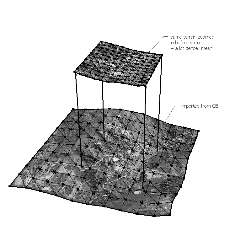
this problem is hard to describe verbally but easy to see:
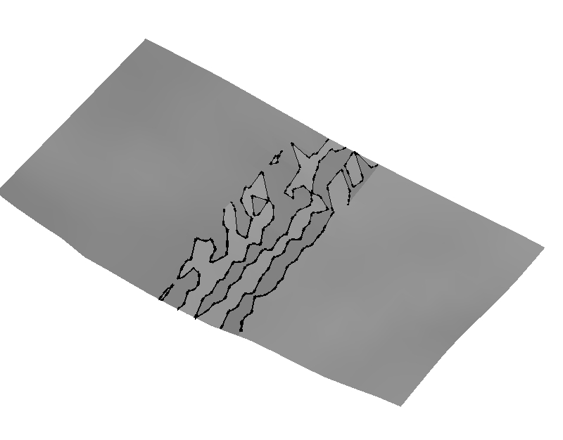
does anyone have any experience changing the resolution of the terrain that imports from google earth? the problem I am having is that no matter how large the viewing area on the google earth screen is, the terrain mesh is still subdivided by the same number of rows and columns. This means that it is less and less accurate the larger the area of land you import is. I have been working with large masterplans lately and would like to keep things fairly accurate because once I export the building models back into google earth they will all be floating or sunken into the ground because of the difference between the SU terrain and GE terrain. See attached.
It seems like one solution would be to stitch together a bunch of zoomed in views, but it I can't figure out a way to import a view that exactly matches with the view next to it. Hope any of this makes sense

-
Hi mirjman -
You can gain resolution by zooming into the Google Earth terrain area and using "Get current view" in SketchUp. Then just move the location in GE and use "Get current view" again, to stitch together a higher resolution terrain.
Other Google Earth/SketchUp topics:
http://sketchup.google.com/support/bin/topic.py?topic=8539Hope that helps.
Cheers,
- CraigD -
Hi Craig, long time no see!

Well actually the problem here is: how to get snapshots that fit together rather than somewhat overlapping and we need to "guess" where the stitchable boundaries are. I think (as a "wish") there could be a possibility to enter a resolution value when importing the terrain.
-
@mirjman said:
......It seems like one solution would be to stitch together a bunch of zoomed in views, but it I can't figure out a way to import a view that exactly matches with the view next to it. Hope any of this makes sense
mirjman,
in addition to previous info:
- set GE to full screen
- hit R to reset North and tilt
- find the desired altitude (say 200m) with the slider in the top/right corner
- move to the right location with [Alt+arrow key(s)] (much more accurate). In doing so you should note specific marks on one side (things like a corner, a tree etc.) In your next import (i.e. ‘Get Current View’) these marks are just about to go off screen.
If you don’t get the overlap with the next imported 'Current View' (in SU zoom in to check) you can click ‘Undo’ in SU, slide back a little bit in GE and import again.
Like this I can get an overlap of about only 0,5m to 3cm on a detailed terrain from altitude 200m. (so not much waste.) And visually matching perfectly in SU. I don’t know how exporting back to GE will take multiple ‘Current Views’ (multiple meshes) at once though. Maybe at the end you need to split your final result into more than one file containing only one mesh each before exporting separately.
Wo3Dan
-
@Wo3Dan: thanks for all the keyboard tips that will help out a lot
I will reiterate what gaieus said, that it seems like you will always have some scrap when using the visual line up technique that will interfere with modeling or take a long time to clean up by hand

-
Just read in the GE Newsletter:
"The Terrain Quality setting allows you to determine how coarse or fine the Earth's terrain appears in Google Earth. This setting does not affect imagery quality, but instead affects how accurately Google Earth displays the elevation of areas in the 3D viewer.
To access these settings, click Tools > Options > 3D viewer tab (on the Mac, click Google Earth Preferences > 3D View tab). Under Terrain Quality, use the slider to choose the appropriate level of detail. Using a Lower (faster) settings improves performance of Google Earth, but terrain appears less detailed. Using a Higher (slower) setting improves the depiction of terrain, but at the cost of performance."Might help...
-
I found a way to import patches of terraing using a pregenerated grid in google earth, and have prepared a script to create this grid http://a4chitect.webng.com/
further info>
http://www.sketchucation.com/forums/scf/viewtopic.php?f=15&t=753you will however still get 'unclean' stitches - but this is impossible to avoid since the imported terrain/imagery from ge isn't always rectangular.
Advertisement


