Measure terrain area
-
Hello!
I would like to measure the area of a terrain subset I created with the sandbox tools.
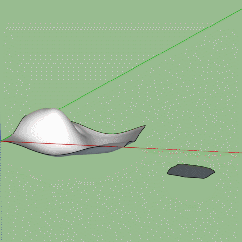
First attempt: freehand tool -> gives me some surface and in the info box its size, but it is usually hovering over the actual terrain (or underneath) as it cannot follow the contours correctly
Second attempt: installed "Draw on Surface" plugin -> doesn't really work on terrains (or maybe I didn't figure out to parameterize the drawing tools)
Third attempt: Select the (sub-)mesh -> only gives me the surface if I were to remove all edges, but I didn't find a tool to do that
I am surprised I couldn't find anything on the internet as this should be a common task for landscape designers or gardeners (in my case).
Thanks for your help! -
Without seeing what you've got, my suggestion would be to use the Soften Smooth dialog in the default tray to remove all any edges on the face of the terrain.
Then create the shape you want and use Intersect with Model to create the edges you need to separate one part of the terrain from the rest.
-
Thanks for the tip.
To elaborate on my problem: imagine you are standing on an ondulated landscape with a chalk spray in your hand. You want to draw lines where the flower beds will go, where the electicity cables will go, the water irrigation, the lawn etc. So you take your spray and walk up and down the terrain, marking each element.
Using your trick I could take a centered top view, take the freehand line tool, start with the highest point, keep it restricted to the horizontal axis (haven't figured that out yet) and start drawing the shape before I pull it out to become the intersection body.
Of course it would be much easier if I could just use the freehand line tool like the chalk spray, but restrict it to the surface of the terrain. Without pressing any additional keys the freeline tool does follow the terrain surface ... sometimes ... and for a while, only to wander off eventually, resulting in a hovering surface.
I experimented a bit more and found that if I start on the face of the terrain, press and hold the up arrow key to fix the freehand line tool to the "pink axis", and go really sloooowly, I'll get reasonably good results.
Any more reliable (and faster) approaches welcome!
-
I would add to Box's overall method in this way: Draw a rectangle large enough to cover the terrain model and move it to a position directly above the model. Apply a transparent material with the paint bucket tool to the rectangle and then make this into a group. If you now go to the top down view (make sure the Camera is in 'parallel projection' in the Camera dropdown menu) you can draw your shape on the transparent flat surface whilst looking at the terrain beneath for reference. Continue then with Box's method of projecting the shape down onto the terrain.
-
An excellent tip there from shawb about using a transparent material so you can see the terrain to follow. You can also change your edge colour if needed, can help if you are using an image or texture.
If you can design your flower beds in 2d with an eye on the terrain underneath then you just need to drape the plane onto the terrain.
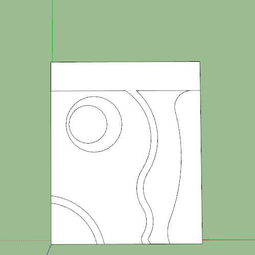
But if you want to wander about on the undulations then you should look further at Fredo's Tools on Surface, they will do what you want with practice.
-
Yes, that makes a lot of sense to me. Thanks a bunch to you both!
Hello! It looks like you're interested in this conversation, but you don't have an account yet.
Getting fed up of having to scroll through the same posts each visit? When you register for an account, you'll always come back to exactly where you were before, and choose to be notified of new replies (either via email, or push notification). You'll also be able to save bookmarks and upvote posts to show your appreciation to other community members.
With your input, this post could be even better 💗
Register Login


Advertisement