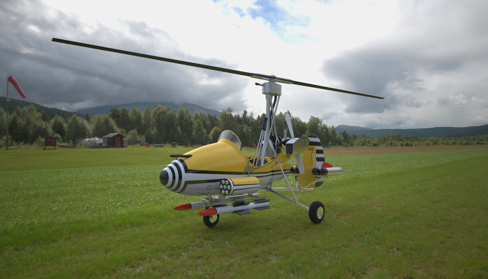
Little Nelly Gyrocopter
-
Many thanks to John (jpalm23) for the link to the airfield HDR. The model i found along time ago deep within the internet. It took some work getting the textures projected and adjusted. C&C welcome as always sketchup & maxwell render.

-
She's a beauty!

John -
Sweet. And what fun is a little get-about like this without a full weapons array?
-
awesome!!

-
Excellent as always.
My only comment would be, a bit of droop on your blades would add to the realism.
I agree the weapons array is vital when it comes to traffic congestion and parking. -
Very nice composition Simon...Great use of Maxwell Render.
allanx
-
Very nice. All you need now is Mel Gibson sitting in the cockpit

A couple of observations --
I know it's an overcast day, but even given that the shadows under the copter seem a bit weak.
And it seems to be sitting on top of the grass.
-
You only live twice!
Well done!
-
Very nice. More with a real plane please.
-
If you want some harder shadows when you work with a HDRI environment i lately imported a simple sphere inside maxwell studio moved it to a height where it can simulate the sun and set a very strong emitter to it. Although it produces some fireflies when the emitter is set too strong you can adjust it nicely with Multilight.
nevertheless nice rendering once again!

-
Thanks for all the comments guys. I'm not sure about the shadow i think it's ok. The rotors should be a little curved and sag your right. Regarding floating on the grass that's a tricky one perhaps i should have added a few grass blades in photoshop in front of the wheels to complete the illusion. Carloh using a sphere may not be the most efficient way as more polygons means more time. I'd suggest a simple plane instead although it'll still add to time.HDR is the quickest solution IMHO and gives the correct lighting.It also means i can easily achieve SL20+ @4mpx in a couple of hours cooking. In this case the illumination intensity is double that of the other channels as it didn't pop enough. I'm still on the look out for aerial hdr maps if anyone has any leads.
Advertisement


