Oops, your profile's looking a bit empty! To help us tailor your experience, please fill in key details like your SketchUp version, skill level, operating system, and more. Update and save your info on your profile page today!
🔌 Smart Spline | Fluid way to handle splines for furniture design and complex structures. Download
Create and export closed polyhedron on Earth's surfaces
-
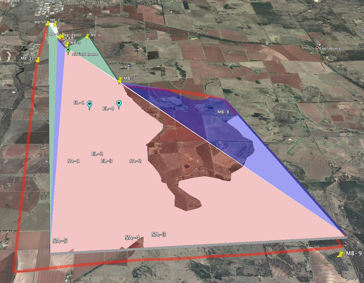
Using posts on these forums, as well as plugins such as TriangulateFaces, I have been able to generate simple polyhedra and visualize them in Google Earth.

This is almost what I need. I have two remaining steps for which I'm hoping to find convenient answers:
- I would like to be able to set the base of my polygon to follow terrain contour, so that the base is a constant height about the ground.
- I want to export the model model as a group of faces with vertex coordinates in lat-lon-alt tuples, ideally as a KML file. Currently, the model that is exported to Google Earth is a KML file containing only a placemark anchor, with the faces and vertices being placed into a secondary DAE file using machine coordinates.
Anyone have tips for accomplishing (1) and (2)?
EDIT: http://sketchucation.com/forums/viewtopic.php?f=323&t=38009 seems to solve #2.
Advertisement


