Question: Georeferencing
-
Dear community,
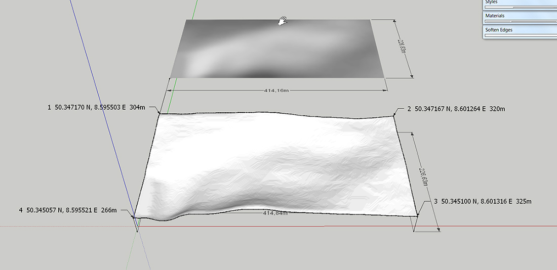
I bought a DVD with digital topographic maps of my country, Hesse, Germany, at a scale of 1:50,000. The maps are digital raster graphics. With these maps, a digital terrain model is stored. Unfortunately, you can not directly export this DTM. The shader can be exported as a bitmap. The geographical position data, height and dimensions are not exported. These data can only taken over manually from the tables of the Viewer (EADS Geogrid
 -Viewer).
The shader I have imported and scaled accordingly with "ThomThoms Mesh From heightmap ". Now I want to georeference the terrain. But I don’t know what point I should choose.
Later on I want to insert a house model that is geo-referenced, at the correct geographical position in the terrain.
There are surely specialists in the forum who are familiar with it.
I would be grateful for any help
Regards
Charly
-
Partial solution (maybe) - copy a tile and change file extension to .txt and open in notepad; if file too large for notepad use metapad (freeware http://liquidninja.com/metapad/download.html). Do you see any obvious locational reference in the text?
-
Hi Charly
I've found a discussion on a linux forum which appears to be about decoding that data format, but my German's a little rusty... http://debianforum.de/forum/viewtopic.php?f=28&t=92002, seems like a lot of your countrymen and neighbours are fighting with this file format.
-
Hi Nigel,
Many thanks for your help.
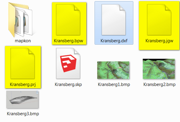
When studying the link I've found that you can open the files with the Global Mapper. This also works. I have exported the terrain as "DXF mesh" and imported it into SketchUp without problems but the geo information will be lost. I am a layman in this field and have no idea how I get the coordinates into SketchUp.
With the DXF file some files are created with those, but I don't know what to do.
Charly
-
Hi Charly
The .jgw file is key to the solution (I don't know what bpw and prj do, although the latter is probably the map projection), as it holds the real-world location coordinates and orientation for the centre of the top left pixel. Normally a dwg/dxf file will have an associated raster file, along with a jgw file which is simply a .txt file, which looks something like this:
1.000000
0.000000
0.000000
-1.000000
263111.187500
4375666.000000where the bottom two lines are the upper left pixel coordinates.
Do you have Autocad or something similar such as Bricscad? If you do this http://www.centremapslive.co.uk/files/autocad_images.pdf shows how to bring the files into .dwg format. At least this way you'll have the images correctly positioned in space, and (assuming the image and dxf file are the same shape), you can then safely position the dxf under the image file.
-
Charly, perhaps I'm looking at your question too simplistically but.... you ask which point to choose?
From your top image you seem to have a terrain in SU, make it a component and set it's axis at a known point, for example the bottom left corner with the lat and long coordinates. Place this point at the origin and then set those coordinates in the model info geolocation.
Sorry if I'm being stupid suggesting this.
-
Maybe you can use the geopositioning of SU and import the better mesh afterwards and use the google earth terrain as a reference for the positioning?
Hello! It looks like you're interested in this conversation, but you don't have an account yet.
Getting fed up of having to scroll through the same posts each visit? When you register for an account, you'll always come back to exactly where you were before, and choose to be notified of new replies (either via email, or push notification). You'll also be able to save bookmarks and upvote posts to show your appreciation to other community members.
With your input, this post could be even better 💗
Register Login


Advertisement