Help Adjusting Terrain
-
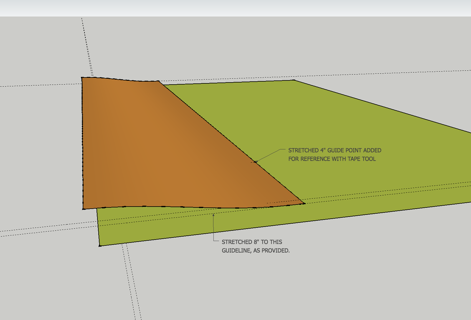
I am working on an exercise and reached the point of placing some terrain but seem to be unable to adjust the perimeter so that it fits into the designated area. What I am trying to do is lengthen one end by 8 inches and stretch the width by 4 inches. I have tried using the move-copy selecting part of the area but what seems to be happening is that either just the edge line moves, or if I am able to move part of it than there is a demarcation line between the extension and the original area. A line which I cannot delete. I have uploaded the file for viewing. So if someone who has come across this problem and is able to assist me it would be greatly appreciated. TIA.
-
If I understand you rightly,
first make the surface you want to scale a group
second hit s (for scale), and scale it to fit the object beneath using the object's scale grips.
You'd be best off going to a 3D view to do this and when you do you'll see snap lines pop up, drag the grip out and you should see [endpoint in group] etc. -
You mean use the Scale tool? Although I only have used this utility for adjusting 3D warehouse models I did attempt it and still cannot get the area to cover all that is required. It just seems to come short or overextends the area altogether.
-
Is the attached what you are after? It's hard to tell exactly what you want to do; these things are often hard to explain.
This is done with scale tool on your existing upper shape.

-
For the 8 inches yes, but the 4 inches is on the left not right-side. The other layers are not showing, in particular the retaining wall one, perhaps turning them on would give a better perspective.
When I tried using the scale tool it would not stretch to 8 inches it either fell just short, or extended beyond the 8 inches. I could only stretch it proportionally or lengthwise, not the width in and of itself.
-
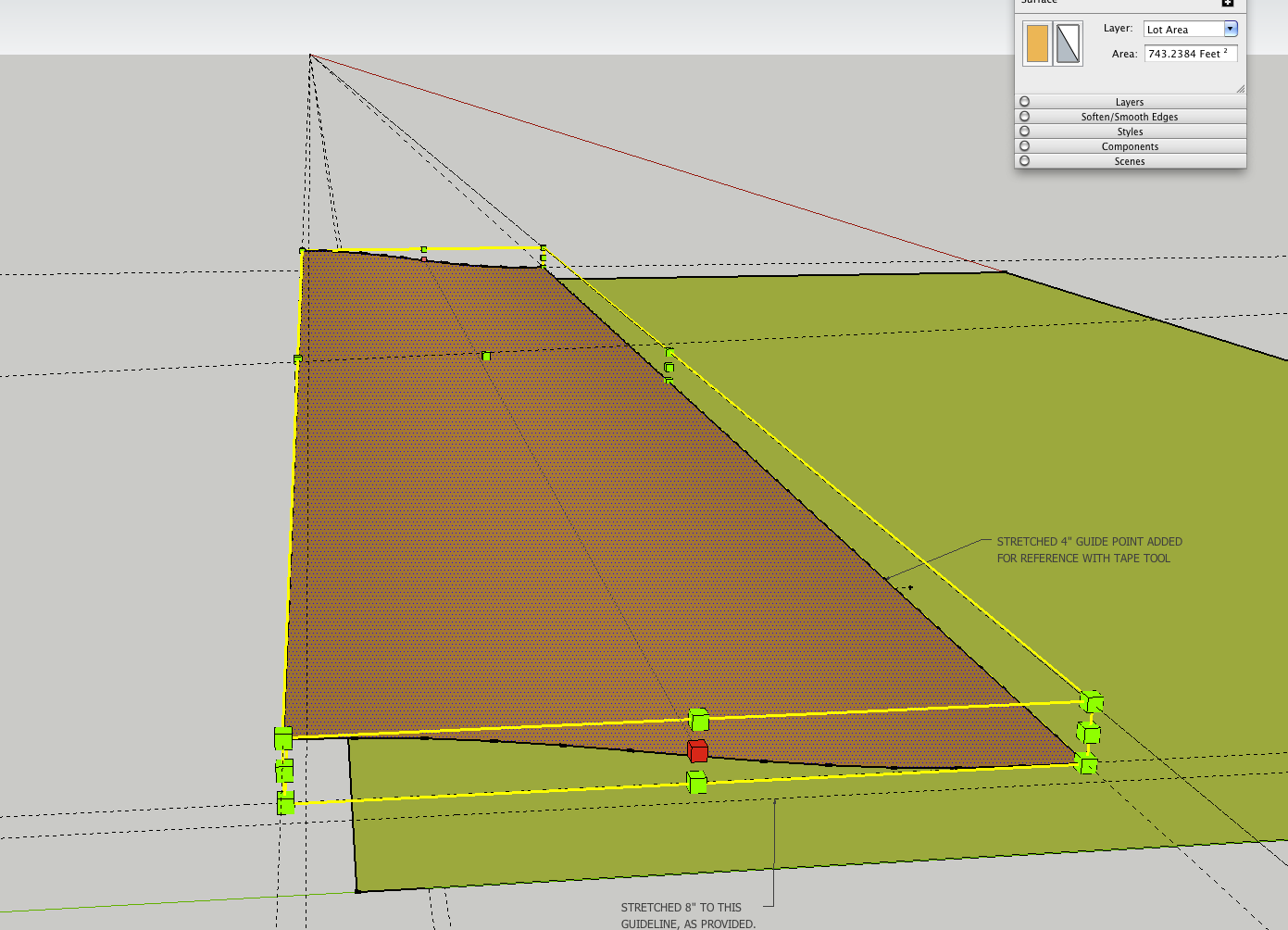
It does work. Select the face and the scale tool. Select the very center /middle scale handle on a side. It turns red. (In this case do not press any modifier keys). Move it about to see it is moving in the way you expect (the shape should be stretching from one side only). Then move the cursor to your guideline (or it could be an edge or vertex in the drawing). You'll see the transformation sort of jump and stop at that line. Let go. I ended up with a form 60'-8" x 12'-4".
[EDIT] That reminds me. I didn't measure until afterwards. However if you knew the shape was 60' long and you needed 8" longer on one side- you can select the handle as above, make a move to any point, and type 60'8". You don't need the guideline if you know the final length.
-
Would you specify which of the handles you used to make the adjustments to the terrain? When I try to stretch it, the terrain does not keep its shape.
-
Please see attached files.
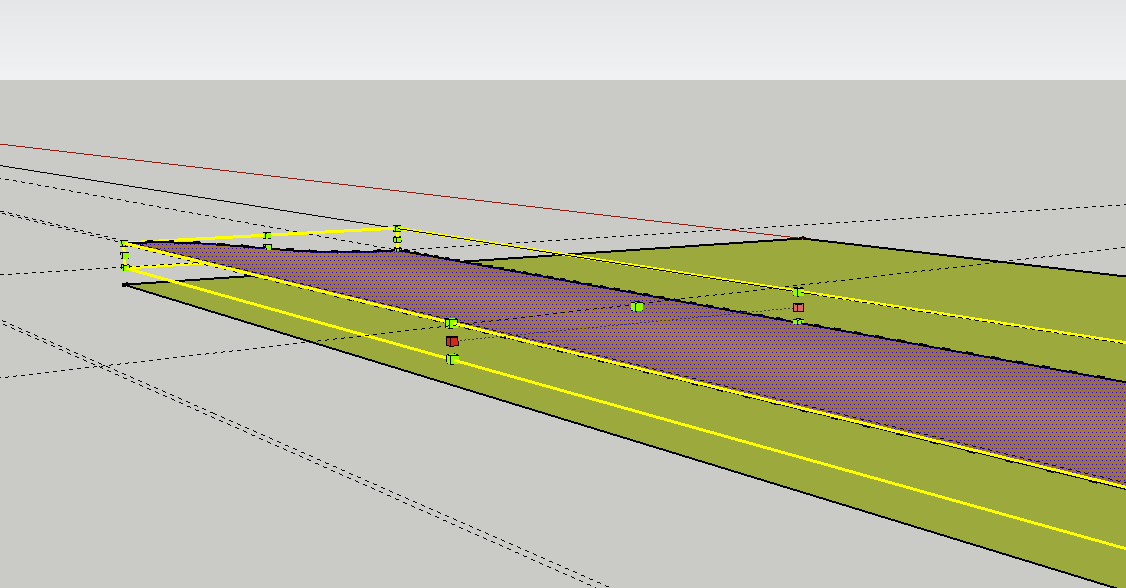
See the closest red handle. Notice the line extending back and the far red handle. The little yellow info box that says "Red scale about opposite point" did not show in the screen shot. This handle will mean the shape's edges will move on the near side line only, and only straight out along the red axis. The grid of hidden lines does become stretched uniformly
In the other direction scaling, the shape will not be exactly the same. Since it has a curve in it, it will stretch that curve some--straight out, but the high/low points and the relative shape should be the same. I assume this stretch is inconsequential for the purposes of showing your terrain.


Advertisement


