Importing 3d buildings from G-earth to SU
-
Hello, me again.
I've just started mapping out a new site using an imported CAD file and was wondering if there's anyway of importing the area including buildings from google earth? I had looked around for the answer but it seems to be something many want to do but no one knows how if not I'll have to redraw everything which would put my project back a whole load with having to model the site before I can work on the actual design aspect of it.I'm using sketch-up pro 8 set for architecture on Xp.
Also, while I'm here, I'm a landscape architecture student and I've noticed there seems to be a version for LA, is there or is it just the same as my current version of 8?Thank you in advance.
Gareth. -
As far as I know, it's not possible. You can only import the terrain 'legitimately'.
Out of interest, I have tried various OpenGL and DirectX 3D grabbers, but none seem to work...at least not in any even vaguely acceptable form. More than that, you can't seem to grab anything looking directly down...only if the horizon is in view. I don't need to point out how much geometry that might capture....and it tends to be in the form of distorted, rectangular placeholders only.All this is for the native content, of course. If any of the surrounding structures are contributions from the 3D Warehouse, you can download them directly from there.
-
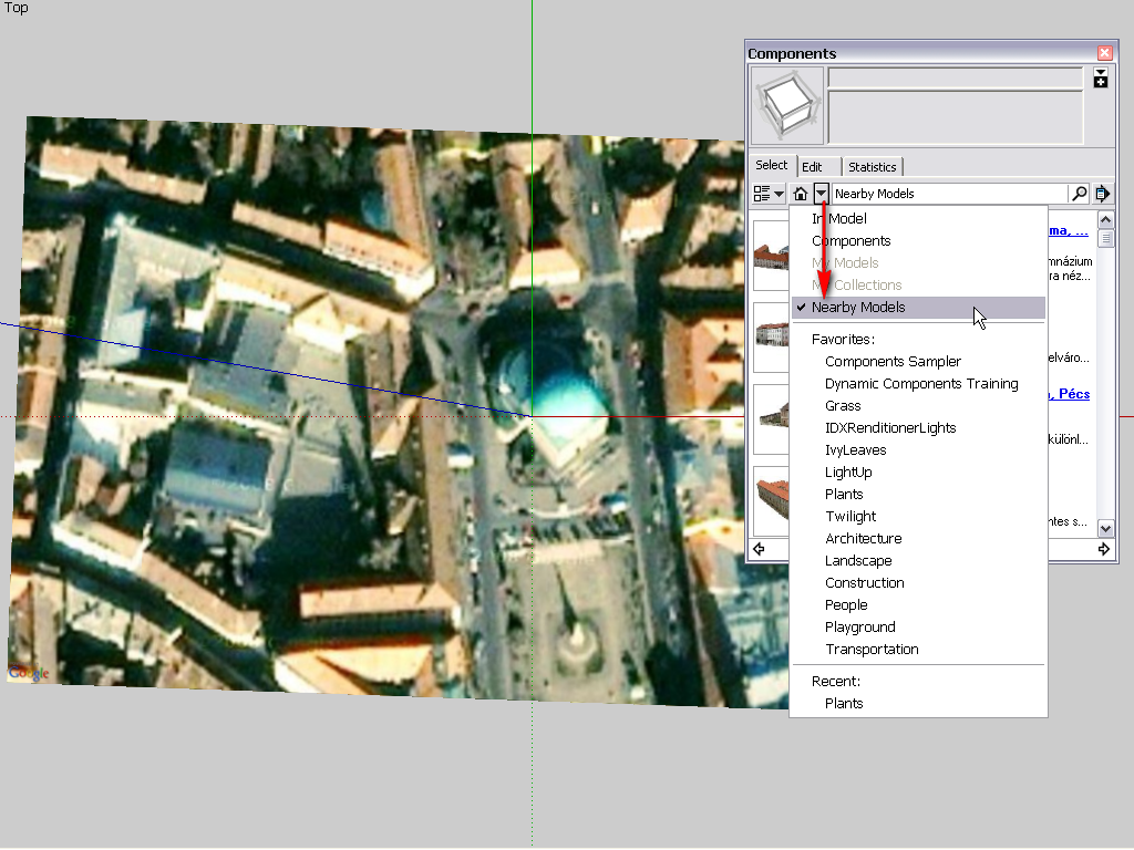
You can "normally" only get what has been publicly shared via the 3D Warehouse as skp files. In your component browser, if you have already geolocated your file, there is a "Nearby models" menu item...

So if you are lucky because- the modeller(s) used SketchUp to build the model (and not Building Maker for instance),
- the modeller(s) used the 3D Warehouse to share the model as an skp file (and not kmz),
- and made it publicly downloadable,You can get these models as regular components downloaded from the WH.
-
Thanks guys, only 3 of the buildings are actually in the catalog but alas they don't match exactly with my CAD plan so I suppose I'll have to redraw a lot of them or at least figure a way of forcing them to my footprints. It was a nice idea while it lasted that I could just import what I could see in Google Earth.
-
You may be interested in this plugin at least:
http://forums.sketchucation.com/viewtopic.php?t=30512 -
Oh man that'd be great but the data files I'm working with are 2d. No short cuts here I don't think. Thanks though, that plugin looks amazing!
-
Unless there's a plugin for turning every face that isn't there into a face after I've imported my .dwgs?
Advertisement


