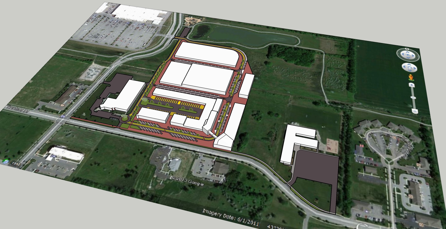
Difficulty properly geolocating my model
-
Hello. I'm at my wit's end trying to geolocate my model for Google Earth. Before I started making the model in Sketchup, I took a screenshot of Google Maps on my browser to model it from. The reason why I did this is because if I added a location with Sketchup, the red and green axes in the model wouldn't match up with the streets in the satellite photo, and it would be much more difficult to model it that way without being able to snap to those axes. Now that I'm done with the model, however, I want to put it into Google Earth as part of a layer I'll share with my boss.
The first problem I ran into was that when I tried to add a location to the model in Sketchup, after I clicked the "Grab" button, the window with the area I selected disappeared and the satellite imagery did not even appear in my model anywhere. To try and circumvent this, I selected the area it should be located at in a new model, and imported the existing model into that new one. This worked alright, except my lines are no longer colored like they should be and some images are missing from the model.
The main problem I'm running into now is that I just can't seem to match up the model I've made with the satellite photo. When I first imported the finished model into the one with geolocation data, it was too small and of course it wasn't rotated right, so I rotated it properly and tried to scale it up correctly. Now I think that literally every move or scale action I do to match up part of the model to the photo messes up two more parts it. I guess this sounds stupid but whenever I have one driveway or building matched between the satellite photo and the model, I look at another part of it and something's completely misaligned somewhere else. I was wondering if anyone has some general advice as to what I should do to make it work right. I'm hoping that there might be some script to do the scaling and moving automatically based on the ground imagery I already have in the model, as I feel like I could sit here all day and do this and still it wouldn't match up.

-
Some things in the model could be out of scale but most problems should come from the satellite imagery being skewed. It is not all shot straight down and it's mapping (stitched from different passes) can be out by quite a lot. If you draw a scaled model from survey or other info, the differences will show.
If you are just saying it is out of scale and you can't find the scale: Group all geometry except the image. Draw a line over a specific wall or other line in the imagery and note the length. Enter the group with your geometry and with the Tape tool draw a guide along the corresponding line in your model. Type the distance you measured from the imagery.
I don't see how you made all that model without it being in scale.
I cannot even get the image to download anymore from "Add Location" myself.
Your lines are colored by Styles. reset that in the new drawing. But if you did "By Axis" it's not going to work with geo-locating, unless you reset the axes to the model after positioning it.
I don't know what you are trying to get out of this. Looks OK to me. If someone picks at your presentation just prepare some technical-speak to make them feel foolish.
-
Thanks for the response; I did what you suggested to find the scale by measuring a line in the image and scaling it to that size. Still, parts of the model didn't match up, but it was just one driveway, which I modified to fit with everything properly. Now it's all correctly geolocated and the model is in my Google Earth layer, which is what I wanted.
Advertisement


