GIS SOFTWARE recommendation reqd.
-
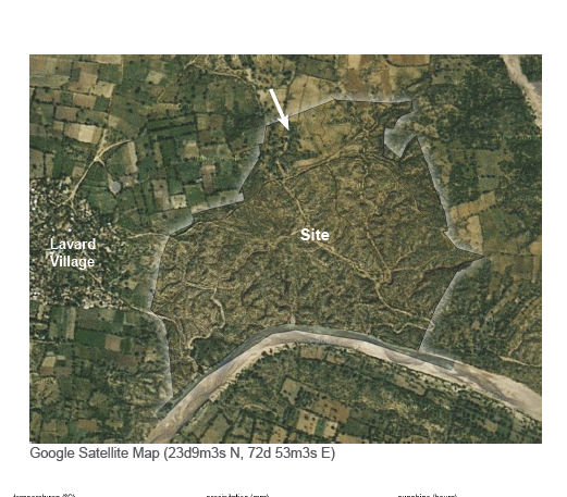
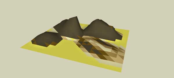
I need to generate slope analysis of a site very quickly using some GIS software. I am a novice when it comes to GIS. Google earth and grabbing a terrain in sketchup is the only thing that I have ever touched upon. These are some samples that I got.
I don't want a heavy duty bulky intimidating software. I just need to do this task. Kindly suggest a suitable solution for me. Moreover, that mesh is a vector linework that was generated.

-
There was a plug-in for Sketchup that did just that - try searching "Color by Slope". I haven't used it recently though. It paints surfaces according to their slopes. There is also a "Color by Height" variant. These might work for you.
-
@cemyapca said:
There was a plug-in for Sketchup that did just that - try searching "Color by Slope". I haven't used it recently though. It paints surfaces according to their slopes. There is also a "Color by Height" variant. These might work for you.
I have tried sketchup but it never works out. Here, http://sketchucation.com/forums/viewtopic.php?f=15%26amp;t=57167

-
Try this and read it in depth (It's Chris' ColorBySlope tool)
http://sketchucation.com/forums/viewtopic.php?f=15%26amp;t=56825%26amp;p=516133%26amp;hilit=+slope+analysis+#p516133vid howto
http://www.sargeantillustration.com/tutorial-slope-analysis-in-sketchup/Subdividing your mesh will help produce a better blur effect but dramatically increase processing time.
You will always get some sort of tiling effect (but turning linework OFF will help a lot) but you can always blur/smudge in photoshop/gimp/fotosketcher
QGIS is the other viable approach but if you know nothing about GIS it's a lot to take on board in an afternoon! QGIS will get you there tho
http://www.qgis.org/en/site/But it's not quick to explain - WELL worth learning tho' for another time.
-
My wife has been working in GIS for years, with ESRI. She recommends qGIS and thinks someone like me (with CAD background) might pick it up OK.
-
Re QGIS - I'm self-taught in GIS and tend to use it for simple things like converting tiff file data (look like a monochrome image file, but each pixel contains for instance height data) into dxfs and so getting a contour file. Currently am working on using it to produce variable-width setbacks for waterway protection - which IS pretty difficult, but like this place there are great communities to ask questions.
-
@pbacot said:
My wife has been working in GIS for years, with ESRI. She recommends qGIS and thinks someone like me (with CAD background) might pick it up OK.
Thanks I will try this with qGIS.

Advertisement


