sketchucation logo sketchucation
    • Login
    Oops, your profile's looking a bit empty! To help us tailor your experience, please fill in key details like your SketchUp version, skill level, operating system, and more. Update and save your info on your profile page today!
    FredoBend | Powerful new bending tool for SketchUp Download

    Finding an Elevation on Google Maps.

    Scheduled Pinned Locked Moved Corner Bar
    3 Posts 2 Posters 536 Views 2 Watching
    Loading More Posts
    • Oldest to Newest
    • Newest to Oldest
    • Most Votes
    Reply
    • Reply as topic
    Log in to reply
    This topic has been deleted. Only users with topic management privileges can see it.
    • KrisidiousK Offline
      Krisidious
      last edited by

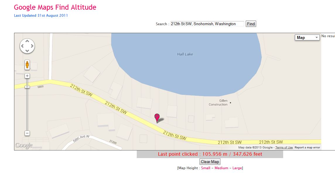
      This is pretty handy... just put in an address or longitude and latitude and then you can move the marker around and find elevations.

      301 Moved Permanently

      favicon

      (www.daftlogic.com)

      By: Kristoff Rand
      Home DesignerUnique House Plans

      1 Reply Last reply Reply Quote 0
      • B Offline
        Ben Ritter
        last edited by

        Although it displays in thousands of feet, don't use for any exact elevations. I tried it on my property and it indicated an area that is supposed to be lower, as higher.

        1 Reply Last reply Reply Quote 0
        • KrisidiousK Offline
          Krisidious
          last edited by

          Where are you getting your height info?

          I just checked again and found it to be less than 1 foot off on a random topo I pulled out of the drawer.
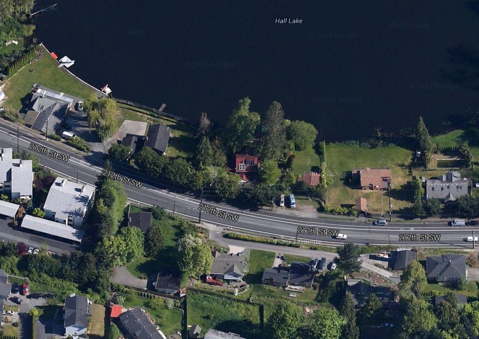
          Here's my info.

          Google Map Location

          https://maps.google.com/maps?q=212th+St+SW,+Snohomish,+Washington&hl=en&ll=47.807091,-122.309968&spn=0.002183,0.003846&sll=48.02805,-121.819153&sspn=0.098385,0.26144&t=h&gl=us&geocode=FcV42QIdIZ61-A&hnear=212th+St+SW,+Snohomish,+Washington&z=19

          mapheighttestmap.JPG

          Google Map Find Altitude.

          mapheighttest.JPG

          Here's the professional survey and topo

          mapheighttesttopo.JPG

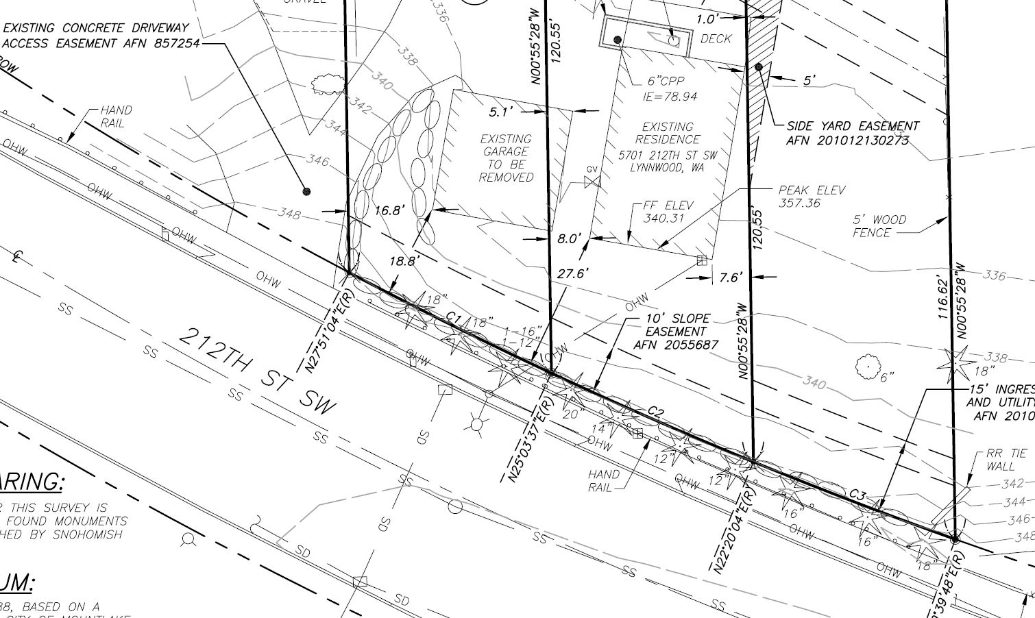
          I'd say that's easily within a foot.

          Let us know how you got your figures.

          By: Kristoff Rand
          Home DesignerUnique House Plans

          1 Reply Last reply Reply Quote 0

          Hello! It looks like you're interested in this conversation, but you don't have an account yet.

          Getting fed up of having to scroll through the same posts each visit? When you register for an account, you'll always come back to exactly where you were before, and choose to be notified of new replies (either via email, or push notification). You'll also be able to save bookmarks and upvote posts to show your appreciation to other community members.

          With your input, this post could be even better 💗

          Register Login
          • 1 / 1
          • First post
            Last post
          Buy SketchPlus
          Buy SUbD
          Buy WrapR
          Buy eBook
          Buy Modelur
          Buy Vertex Tools
          Buy SketchCuisine
          Buy FormFonts

          Advertisement