Google Maps Street View: How to extract 360°?
-
Hi friends,
I am loving the street view option in Google maps.
Is there a way you can download the current view as a 360 panoramic?
I would like to use it in my Archviz projects as a skydome.Possible?
-
I have an answer for you Kwist. I was wondering that myself. The answer is that you can...but it's nothing like as straightforward as right-clicking and saving the image anywhere. Nor is the image a single pano...like an Adobe mov file...but is made up of a whole collection of images, presumably pasted onto a hemisphere. That's what you can actually see happening on a computer with a slow connection. So it's going to require a stitching job.
I can only get it to work on an XP machine and only in Internet Explorer...the reason being that Firefox caches all its browser content; and I've no idea where Vista hides it...maybe it caches it too.What you need to do is go to the Street View you are interested in and allow it enough time to fully load. Then open up My Computer and navigate to C:\Documents and Settings\Your Account\Local Settings\Temporary Internet Files. You'll need Hidden Folders displayed to do this. There'll be a whole bunch of jpegs at the end of the list (with panoid in the filename). Happy stitching.

-
Ive been working with skydomes also just recently for about 3 weeks.
In that time i created HDRI skys with this program http://www.hdrlabs.com/picturenaut/.
There is an exe program that is called sky that comes with it and you can make your own hdri skys. Just create your text and a batch file for it. After i made my skys i wanted also to use
Google sketchup to use just the clouds for my HDRIs but never did.
You can also use MySkymaker.blend for blender and change the png and save it as an HDRI in the node editor. -
Please, folks, keep these cool tips coming. I've been extremely interested in these 360 deg images lately (both for HDRI and for browsing reasons either in GE or alike).
Very useful info so far, thanks.
-
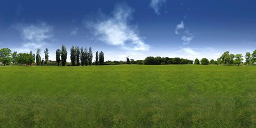
I'm sure you're all familiar with autostitch, but having used it for years for making wide panoramic photos for fun I discovered fairly recently that, as long as you use a tripod and fixed ISO settings (as low as possible) it will stitch sets of photos together to form an almost perfect 360° spherical panorama.
There are a few tricks- the main one being that the sky, especially the upper portion will usually be way too bright so the photos will be extremely over exposed i.e. 255,255,255 white and autostitch can't stitch them. It's better to just photoshop a rendered sky in afterwards. So I just take approx 15 photos of the horizon, then the same number with the camera rotated up a little, just to make sure any close trees or buildings are fully in shot and then the same again with the camera rotated downwards as much as possible while still leaving a considerable overlap with the horizon photos.
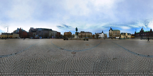
Of course you'll need to crop the image and then resize the canvas so it's 2:1 aspect ratio, with the horizon in the exact middle so it'll map spherically and render accurately. It doesn't matter that the very bottom is a bit messy as the spherical mapping is usually messed up at the poles anyway. If it's windy and low clouds were altering the light levels a lot during the photographing process (it usually takes about 10 minutes) you'll probably need to do some dodging and burning to even out areas of the final pano.
The only real limitation (other than time of course) I've found is RAM- my measely 1.5Gb are eaten up for about 20 minutes while autostitch makes a 15000 px wide 80% compressed jpg and after adding the new sky and general touching up in PS I always have to restart my laptop before continuing with any effective work.
In other words (LOL).... I've never tried, but I'm sure autostitch will stitch those Google maps images together really easily.
-
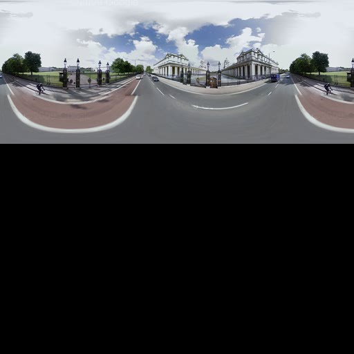
If you don't have any stitching software you can actually use SU to join the images. Apparently I didn't wait long enough for them all to download...either that or some just went missing from yesterday...because a few don't appear to be in the Temporary Internet folder. They are arranged in no particular order, but luckily, you get a low res overall image that you can use like the picture on the lid of a jigsaw box.
You can arrange them in SU, then explode them, then use the new command in V7 to Combine Textures and output a perfectly stitched pic.
Attached is the low res original...presumably it's higher res in Google Maps and just gets sliced in some way. I also attached the assembled (almost) SU file.
-
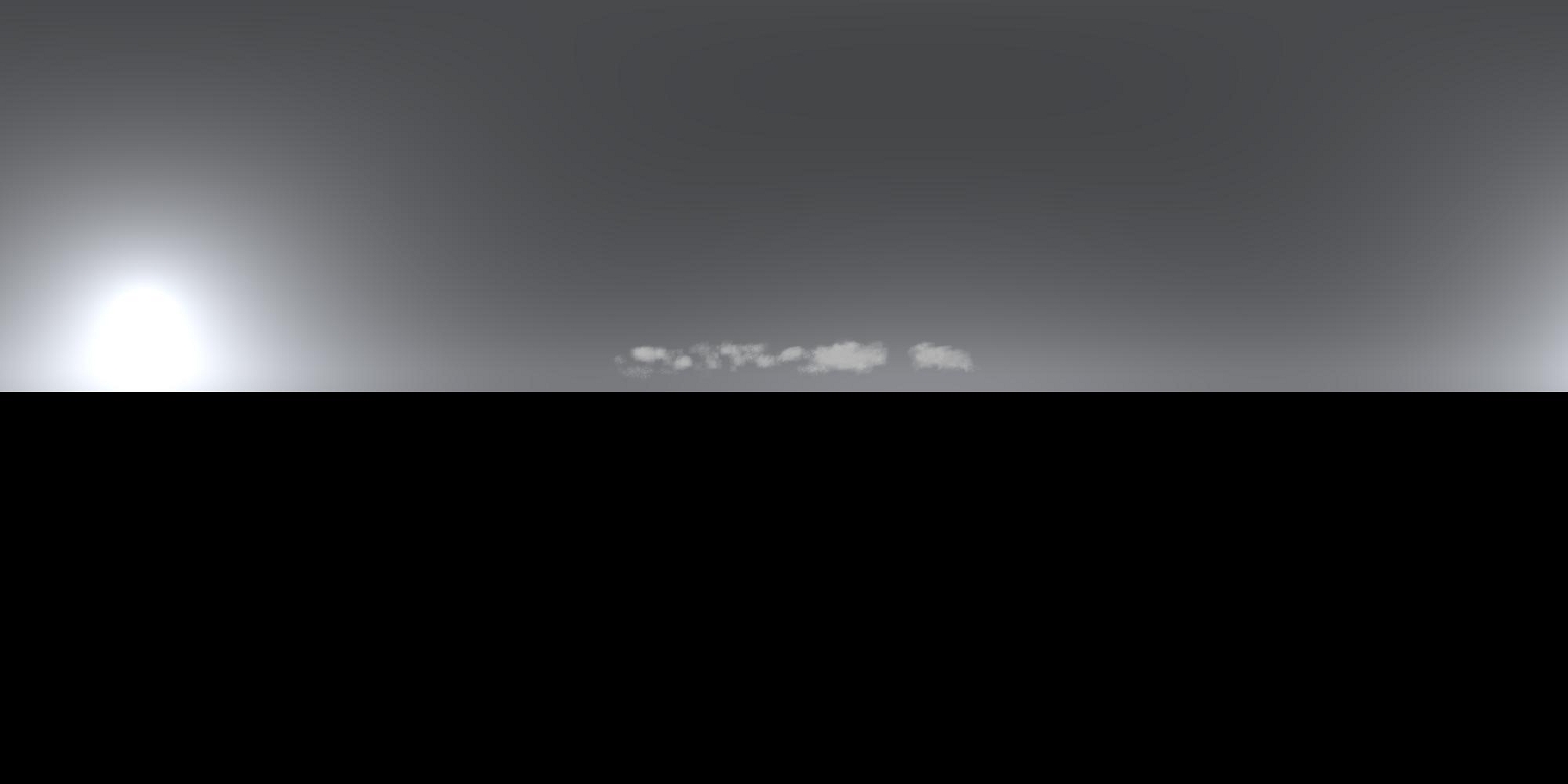
Here's an example jpg from an hdri. I tried extracting clouds from Google earth but found it hard to do that, and use the Gimp for making clouds.
-
Here's a batch file for Sky.exe to make HDRI's. Just click on the batch file and HDRI is created automaticaly and your editor is open automaticaly also. Your editor can be PhotoShop or just a viewer that can read PFM files.
Named of batch file i use: Preetham Sky.bat
The text for this batch file is:
Sky [INPUT.PFM] OUTPUT.PFM /K /H=1000 /W=2000 /A=7 /B:=3 /C=12 /D=7 /E=3 /F=32.3 /G=-106.917 /S=2.6179938 /T=2.84
OUTPUT.PFMThis are your options:
Sky [INPUT.PFM] OUTPUT.PFM
OPTIONS:
/I CIE Standard Overcast Sky
/J CIE Clear Sky
/Z CIE Partially Cloudy
/K Preetham Sky
/L:[float=0.109] Red Color Sky (not for Preetham Sky)
/M:[float=0.349] Green Color Sky (not for Preetham Sky)
/N:[float=0.680] Blue Color Sky (not for Preetham Sky)
/H:[int=256] Height
/W:[int=512] Width
/A:[int=6] Month
/B:[int=17] Day
/C:[int =10] Hour
/D:[int =12] Minute
/E:[int =5] Second
/F:[float=10.9625] Longitude
/G:[float=45.3545] Latitude
/S:[float=0.261] Standard Meridian
/T:[float=1.0] Turbidity (only for Preetham sky model) -
What is "Sky.exe"?

-
This one here. http://www.hdrlabs.com/picturenaut/plugins.html
Just click on sky on the left.
-
I asked my youngest brother, about this and he sent me this sites.
http://gizmodo.com/gadgets/office-voyeurism/the-google-maps-street-view-camera-264972.php
http://gadgets.boingboing.net/2008/06/17/google-street-view-c.html -
Hi there,
I found this interesting page on the Google Maps API.
apparently it is possible to extract the whole panorama:http://code.google.com/apis/maps/documentation/services.html
Unfortunately, I am not a coder...
This makes me think: would it be possible to setup a 'plugin' that makes a 360° panorama (LatLong) using the code above and map the obtained panorama on a cilinder or sphere to be used in Sketchup?
That would be awesome.
For each new project, you just run the plugin and your backdrop of the real environment is in your Sketchup file......
Possible? .... -
Which bit do you think it is that lets you make panoramas? I can only see the GStreetviewPanorama object, which is just an API for the normal streetview as far as i can tell.
-
@remus said:
Which bit do you think it is that lets you make panoramas? I can only see the GStreetviewPanorama object, which is just an API for the normal streetview as far as i can tell.
The procedure to do it manually is described here by Swilsonmc:
Basically, all we need is an automated script to get the 21 images that make the whole panorama.
From there, we can use a photostitcher (e.g Autopano) for assembly and map the panorama to a sphere/cilinder in Sketchup... -
There is this new function in SU 7.1 "Get Photo Texture", which lets you grab (at least "some" of) the street view panorama (for texturing purposes, not for grabbing the whole panorama, by default).
Now if I am not mistaken, this new feature (thank Scott Lininger) is driven by a ruby script "webtextures_loader.rb" in the Tools folder\WebTextures. Now if someone could look more deeply into that plugin and see what can be done...

-
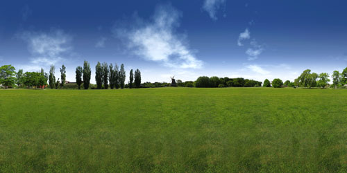
Hi all i am looking for hdr images using with V-ray viewing like this image where can i find this. It's really necessary. Thanks.
-
-
Hi, folks.
I found your discussion while looking for links back to my Flickr pages. I don't personally use Sketchup but have spent time looking into Google's Street View panoramas. After glancing over the other posts I thought I would offer a few ideas.
I recently posted some additional instructions on how to obtain the 21 images that make up each panorama, including a way to automatically grab them for each stop along driving directions.
If you read the comments under the related images you'll see where I try to clarify to another user that the 21 images make up an already-stitched panorama. This means that Google has already rendered the equirectangular panorama and therefore no need to stitch the 21 images. Instead, just arrange them like a puzzle.
I hope this helps.
-swilsonmc -
Here is another easy way to get the image tiles from Street View: http://jamiethompson.co.uk/web/2010/05/15/google-streetview-static-api/
It looks like it only works in UK though as it needs a Postcode, although I may be too dense to see how its done elsewhere.
Advertisement


