Model renders in Google Earth
-
Hi,
It might be cool to see a few SketchUp artists works rendered dynamically in Google Earth. I often enjoy viewing SketchUp buildings with sunlight on and clouds and saving jpgs of my favorite shots. Thanks,
Zach
Here are a few that I've made,
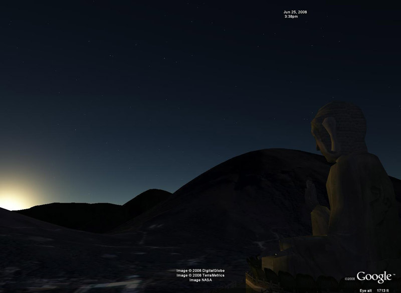
Tian Tan Buddha, Lantau Island, Hong Kong (3D Warehouse)
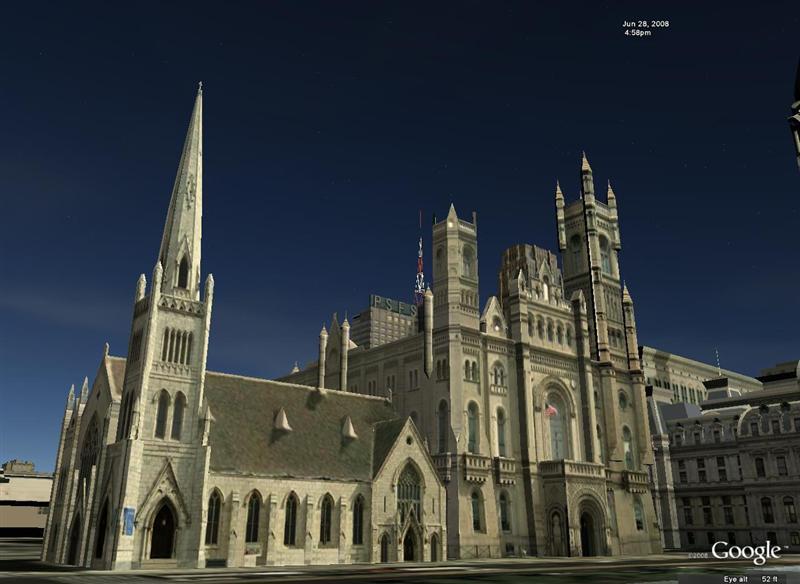
United Methodist Church and Grand Masonic Lodge of Pennsylvania, Philadelphia (3D Warehouse)
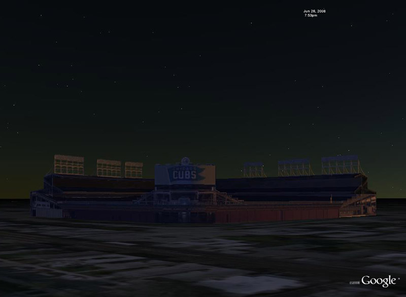
Wrigley Field, Chicago (3D Warehouse)
-
That's a thought: Google Earth as a rendering package.
I'm not sure my clients will be too thrilled with that little corporate trademark in the corner of every image though.
-
@lewiswadsworth said:
...I'm not sure my clients will be too thrilled with that little corporate trademark in the corner of every image though.
 Lewis, you can crop that off any time
Zach,
Now, as there is the sun and shadows in GE there can indeed be a couple of nice shots made. If only the first and especially the last images could be artificially lit!
-
Yeah, I saw some need for post-production on some of these, but avoided it so we could compare lighting at different times of day. Actually, Gaieus, the last image is quasi-artificially lit, since I first hovered my mouse over the model (to give it that blueish hue) and saved image by using keyboard shortcuts
Zach
-
Yeah, I can see the hue - funny trick!
I just revisited the models by a local "enthusiast" (geobéka - "GeoFrog
)in my town and wow, he has made quite a nice progress! I'll need to tecah him a couple of trick though so he can make cleaner and more "GE friendly" models. Here are some shots:


")
And here is what I would like to see in GE - this church was here until the Turks built their mosque in its place in the 16th century. Give me a history layer with a time line slide in GE!BTW - who are the QA engineers for the WareHouse now (especially those who were in BaseCamp and I may have met them)?
-
Sweet, he has produced some very nice models! I've wondered what Pecs means? It looks similar to the Czech word 'pec' which means oven or furnace.
Yeah, a building history time slider is an awesome idea, I'm sure it can be done through KML. Could be a nice summer evening project, too! Imagine being able to watch cities change and grow over time.
Lates,
Zach -
@cerevellum said:
Sweet, he has produced some very nice models! I've wondered what Pecs means? It looks similar to the Czech word 'pec' which means oven or furnace.
it's the name of the city.
-
Yeah, it's the name of the city and there are two main theories where it comes from. One is what Zahc says - furnice or oven (also similar in Crioatian) but also the Slavic word for "five" sounds similar. Now that the late Roman early medieval name for the city was "Quinque Basilicae" (five basilicas) in Latin, then the later medieval name was "Quinque Ecclesiae" (five parishes) and it is still called "Fünfkirchen" (five churches) in German, this could also be a solution.
There are late Roman - early Christian - chapels and churches (part of the UNESCO World Heritage) but so far we know 24 of them. Maybe the names come from some of these.
Now they are mostly under the current ground level. How could I show them in GE, Zach? Not just a history layer but also the ability to cut through the GE terrain is needed!
-
Thats cool to know! I have been to Budapest, Hungary once before and very much enjoyed it. The spas were really nice (beautiful if I remember, and my pictures continue to demonstrate) but unfortunately I had slept in till 4pm and got to the spa right as it was closing
I would like to push for a "shovel" tool of sorts for digging into Earth, like for foundations or what you described. Given time and I'm sure it will only get better!
Here is a render of a building I'm very pleased about: Chicago Title and Trust. One of my favorites for sure! Enjoy!
Take care,
Zach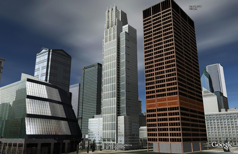
-
Yeah, definitely better when there are more (basically ALL) the buildings present in a scene like this and you don't need to find a viewpoint to fill the screen with some very few ones in the neighbourhood
-
These shots look cool. Where are the controls in GE to do shadows, clouds, etc.? I looked but couldn't find them.
Thankx,
Tom -
Hi Tom,
Clouds are found under the "weather" layer. Sunlight can be turned on (as long as you are using Google Earth 4.3) by hitting the button in the top row of icons (next to sky).

I agree with Gaieus' statement about context. I think all these things combined and you can produce some nice screenshots!See ya,
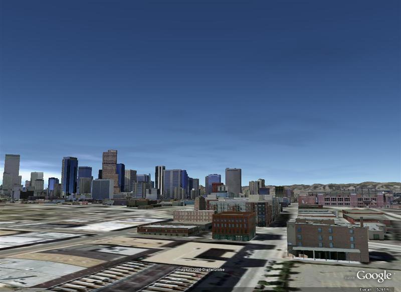
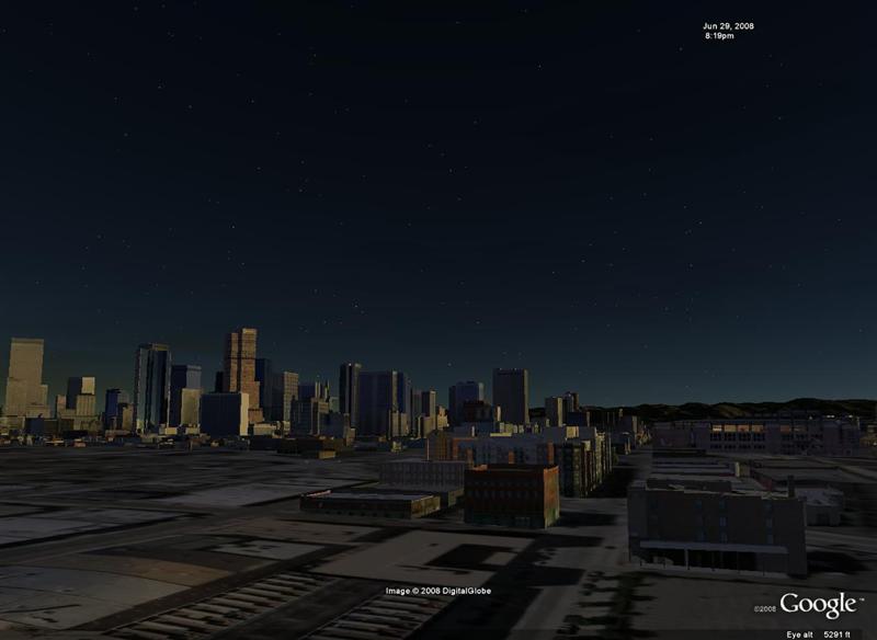
ZachHere's a day and late evening shot of Denver:
Hello! It looks like you're interested in this conversation, but you don't have an account yet.
Getting fed up of having to scroll through the same posts each visit? When you register for an account, you'll always come back to exactly where you were before, and choose to be notified of new replies (either via email, or push notification). You'll also be able to save bookmarks and upvote posts to show your appreciation to other community members.
With your input, this post could be even better 💗
Register Login


Advertisement