Procedural terrains
-
two words.
thank you.
pav
-
Another go at creating an accurate terrain and came up with this:
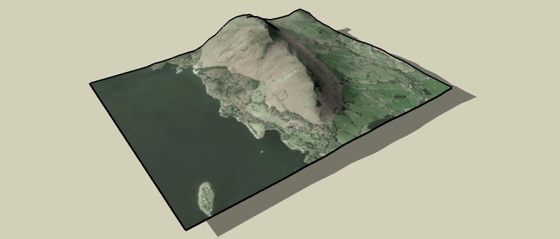
Created this by using this site to create a 30x30 grid of lat, lon and elev data.
Converted the lat/lon to UTM (meters).
Imported into su with the points cloud ruby.terrain quick.skp
Solo, I thought that using the srtm data with 3DEM to give images like this
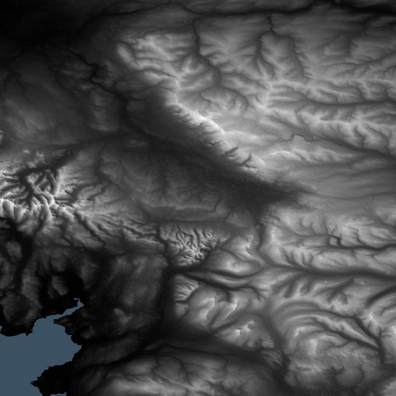 and used with your method could produce some good results...
 -
Richard,
This site uses GE terrain data, doesn't it? (at least to me it seemed so). What way is it better then than importing terrain from GE?
-
@gaieus said:
This site uses GE terrain data, doesn't it? (at least to me it seemed so). What way is it better then than importing terrain from GE?
It grabs the elevation data from usgs seamless elevation data sets, which includes SRTM data (among others) According to wikipedia GE uses srtm data and supplementary dem data to fill gaps. So that site does use very similar data to GE.
As you will see from the skp below there is a difference in the geometry obtained from GE and from this site.terrain compare.skp
The geometry from GE is lower detail - (unless you know how to improve this?)Anyway I was just experimenting to see what could be done
-
@rsw said:
(unless you know how to improve this?)
Forget that, zoom in closer in GE and import into SU, then move along in GE and import into SU again, repeat until you've got the area you want (doesn't give a single terrain object and seems to import image as greyscale but is more accurate).
Can't believe I missed that

-
Yes, I know this workaround but it will also give you rather clumsy results at the end when you try to stitch them together.
It's actually a great feature in GE that the farther you are the less detailed everything is (otherwise it wouldn't be able to stream) but there should be a way (some option in SU) to import higher resolution terrain data.
Interestingly, we have another discussion about this (and related stuff) in another forum with bjornkn & JClemens.
-
Gaieus,
Can you post a test file or link to a data file? I would like to test the cloud ruby. -
Lapx,
There is an "exmple.dat" file at Didiers site that you can downoad (and it's also fun at the end)
http://www.crai.archi.fr/RubyLibraryDepot/Ruby/em_geo_page.htm
Go down to cloud.rb and it's on the right side. -
Thanks Gaieus,
But I get thid error message after loading the example "ioc_dat.gif" file.
Any idea what the problem might be?
-
Ok, got the dat file to download now. Now it does nothing

-
Got it to work. Make sure you have the latest ruby

Now I need to find practical ways to apply it.
Where would one get or create the data files where they could be applicable? -
What I useit for is to reconstruct ancient ground surfaces that we explore during archaeological excavations. We set up a co-ordinate system and do the surveys ourselves during the digs. xyz co.ordinates. They are then easy to enter through the script. The more accurate the survey is (i.e. the more point we measure) the more precise the mesh is.
-
I guess as I was thinking, a powerful use for 3d would be using it to actually displace difficult to model textures i.e. frieze detail on ancient structures. But this may be overmodeling depending on how close you are to the model.
-
Does someone have a quick way to convert the generated list of coordinates in the page:
http://www.zonums.com/gmaps/terrain.html
to UTM?
It is not related to sketchup, I need it for my work. (I have the tools to convert it, but just one point at time).
-
-
mirjman, you saved my life today

Just a size limit of 500 points in:
-
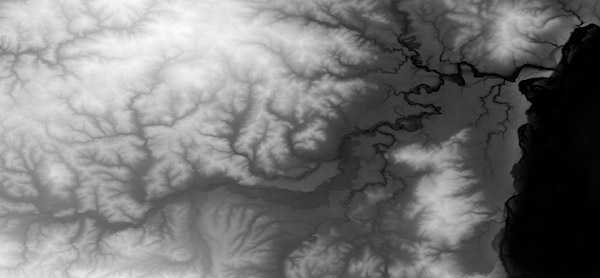
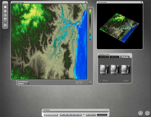
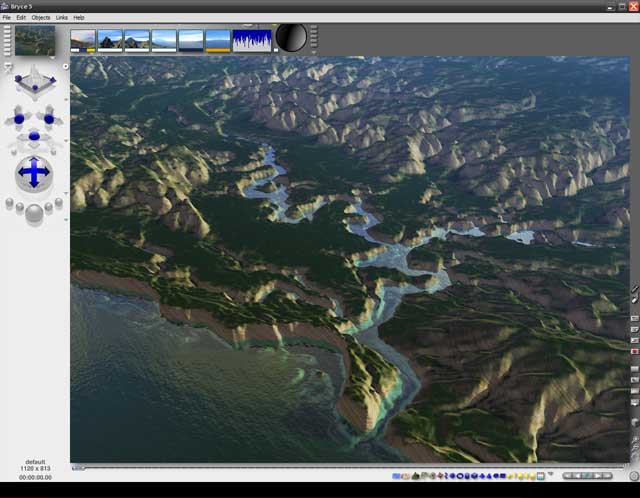
hi, according to me, if you can get a grayscale height map of your terrain, you'll do some magic with Bryce.
For those who don't know it, Bryce is s landscape renderer and you can download a legal copy of version 5.5 for free - just check the webpage of Daz, who now owns it. The render engine is a bit outdated, but the terrain editor still rocks.Start with a grayscale map like this beneath (found at http://www.photoshoproadmap.com/)
-
load this image into the terrain editor, and it will automatically converted to a 3D mesh: you can set the grid resolution of the mesh. In this case I've chosen a 640x640 units grid, and set a color gradient that helps me understand better the terrain morphology.
-
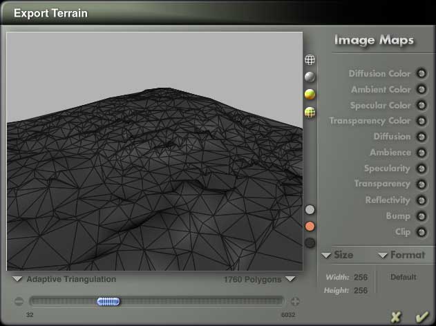
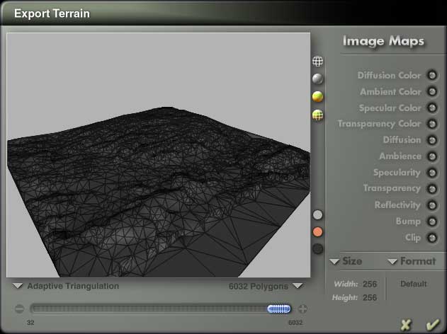
now there comes the best part: you can export the terrain as .dxf or .3ds file. In the export panel there is a slider that will optimize the poly count of your terrain. This function is perfect for exporting to sketchup, since a low poly mesh will be handled much better. The algorithm to decimate the mesh is really fair and it offers you two ways to do it.
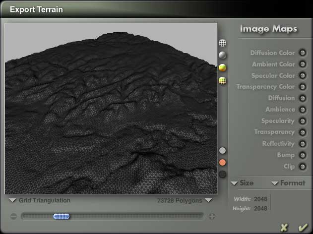
-
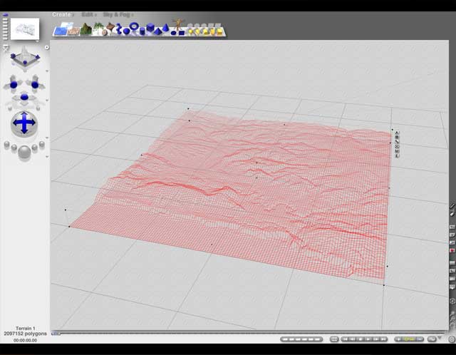
The terrain editor offers you the chance easily modify some part of the mesh by "repainting" it or by applying erosion filters.
It's useless to say that Bryce's Terrain Editor is a great organic modeler and you can create many more shapes than terrains. There is plenty of tutorials in the web.


Hello! It looks like you're interested in this conversation, but you don't have an account yet.
Getting fed up of having to scroll through the same posts each visit? When you register for an account, you'll always come back to exactly where you were before, and choose to be notified of new replies (either via email, or push notification). You'll also be able to save bookmarks and upvote posts to show your appreciation to other community members.
With your input, this post could be even better 💗
Register Login


Advertisement